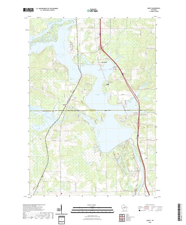
2022 Map of Dancy
USGS Topo · Published 2022About this map
Knowlton and Dancy anchor this central Wisconsin landscape at the convergence of several major waterways. The dominant feature is Lake Dubay, an impoundment of the Wisconsin River that also receives the waters of the Big Eau Pleine River and the Little Eau Pleine River. This complex aquatic system creates a network of marshes and lowlands, most notably around Big Island in the northwest. Local history is preserved at several points of interest near the settlement of Knowlton, including Saint John the Baptist Cem, Knowlton Cem, and the Saint Francis Xavier Cem Old. The map documents a rural transition zone where Marathon and Portage counties meet, showing a grid of local roads like Old Dancy Rd and School Rd that connect family farms and shoreline developments to the primary regional transit corridors.
Find a feature on this map
53 named features on this map. Tap any name to fly to it.
Don’t see what you’re looking for? This feature index may not catch every label — zoom into the map to look around manually.
Map Details
Editions of this 2022 Dancy Map
This is the sole edition of this map. No revisions or reprints were ever made.
Other maps of this area

1899 · Wausau
USGS Topo · 1:125,000

1902 · Wausau
USGS Topo · 1:125,000

1902 · Marathon
USGS Topo · 1:125,000

1953 · Wausau
USGS Topo · 1:48,000

1953 · Marathon
USGS Topo · 1:48,000

1955 · Green Bay
USGS Topo · 1:250,000

1956 · Milladore
USGS Topo · 1:48,000

1956 · Stevens Point
USGS Topo · 1:48,000

1963 · Marathon
USGS Topo · 1:62,500

1963 · Wausau
USGS Topo · 1:62,500