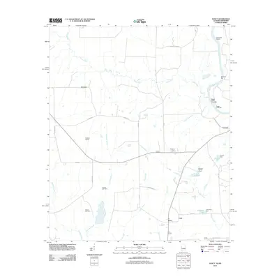
2011 Map of Dancy
USGS Topo · Published 2011About this map
Dancy and Cochrane serve as the primary points of settlement along this stretch of the Alabama-Mississippi borderland, where the Tombigbee River meanders through a landscape defined by its riparian bars and shoals. Features like Colemans Shoals and Bogue Chitto Creek Bar illustrate the river's historical navigation challenges, while the inland terrain opens into the Foxtrap Prairie. The map documents a significant network of local water management, evidenced by numerous named impoundments such as Kimbrells Lake South and Johnstons Lake, held by the Kimbrell Number 1 Dam and Johnstons Dam. Rural community life is anchored by family and congregational landmarks, including Hebron Church and its adjacent Hebron Church Cemetery, along with the Cluster Cemetery and Adams Cemetery, providing essential data for regional genealogical research.
Find a feature on this map
43 named features on this map. Tap any name to fly to it.
Don’t see what you’re looking for? This feature index may not catch every label — zoom into the map to look around manually.
Map Details
Editions of this 2011 Dancy Map
This is the sole edition of this map. No revisions or reprints were ever made.
Other maps of this area

1953 · Meridian
USGS Topo · 1:250,000

1953 · West Point
USGS Topo · 1:250,000

1957 · Meridian
USGS Topo · 1:250,000

1958 · West Point
USGS Topo · 1:250,000

1963 · West Point
USGS Topo · 1:250,000

1965 · Meridian
USGS Topo · 1:250,000

1970 · Aliceville North
USGS Topo · 1:24,000

1970 · Aliceville South
USGS Topo · 1:24,000

1970 · Warsaw
USGS Topo · 1:24,000

1973 · Panola
USGS Topo · 1:24,000