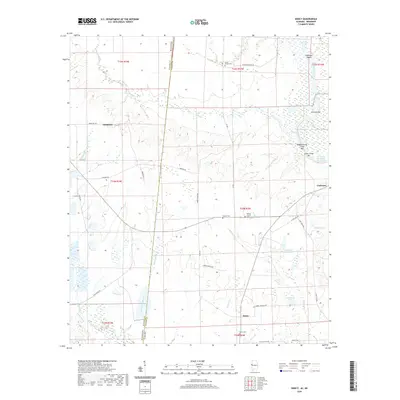
2020 Map of Dancy
USGS Topo · Published 2020About this map
The Tennessee-Tombigbee Waterway defines the eastern edge of this landscape, where the Tombigbee River snakes through a complex network of bars and shoals like Clantons Bar and Colemans Shoals. This borderland between Mississippi and Alabama is dotted with small rural centers, including Dancy and Cochrane, connected by a web of local routes such as Nanny Clark Rd and Wood Bridge Rd. The terrain is deeply carved by numerous drainages, most notably the Bogue Chitto and Duck Pond Branch, which feed into the primary river system.
Find a feature on this map
49 named features on this map. Tap any name to fly to it.
Don’t see what you’re looking for? This feature index may not catch every label — zoom into the map to look around manually.
Map Details
Editions of this 2020 Dancy Map
This is the sole edition of this map. No revisions or reprints were ever made.
Other maps of this area

1953 · Meridian
USGS Topo · 1:250,000

1953 · West Point
USGS Topo · 1:250,000

1957 · Meridian
USGS Topo · 1:250,000

1958 · West Point
USGS Topo · 1:250,000

1963 · West Point
USGS Topo · 1:250,000

1965 · Meridian
USGS Topo · 1:250,000

1970 · Aliceville North
USGS Topo · 1:24,000

1970 · Aliceville South
USGS Topo · 1:24,000

1970 · Warsaw
USGS Topo · 1:24,000

1973 · Panola
USGS Topo · 1:24,000