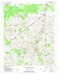
1952 Map of Dancyville
USGS Topo · Published 1981About this map
The lowlands of Hatchie Bottom define this West Tennessee landscape, where the Hatchie National Wildlife Refuge borders the slow-moving Poplar Creek. The terrain transitions from these wetlands into a rolling upland settled by farming communities like Dancyville, Asbury, and Wilkinson Corner. The settlement pattern of the mid-20th century is clearly visible through its network of local institutions, including Antioch Ch, McKenzie Chapel, and several rural schoolhouses such as Douglass Sch and St Johns Sch. Transport routes like the Louisville and Nashville railroad and the Broadway of America highway cut through the region, connecting these small Haywood and Fayette County communities to the wider state. Geologic and local landmarks like Morton Hill and Richmond Hill rise above the drainage basins of Jeter Creek and North Fork.
Find a feature on this map
38 named features on this map. Tap any name to fly to it.
Don’t see what you’re looking for? This feature index may not catch every label — zoom into the map to look around manually.
Map Details
Editions of this 1952 Dancyville Map
2 editions found
Other maps of this area

1950 · Sunnyhill
USGS Topo · 1:24,000

1950 · Brownsville
USGS Topo · 1:24,000

1951 · Brownsville
USGS Topo · 1:24,000

1951 · Sunnyhill
USGS Topo · 1:24,000

1952 · Stanton
USGS Topo · 1:24,000

1952 · Lambert
USGS Topo · 1:24,000

1952 · Dancyville
USGS Topo · 1:24,000

1952 · Laconia
USGS Topo · 1:24,000

1952 · Stanton
USGS Topo · 1:62,500

1956 · Blytheville
USGS Topo · 1:250,000