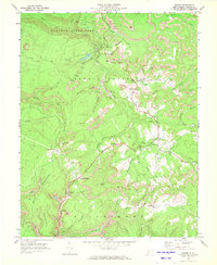
1969 Map of Danese
USGS Topo · Published 1972About this map
Sewell Mountain and the high plateaus of Fayette County define this landscape, where the coal industry and mountain communities intersect during the late 1960s. The northern portion of the map is dominated by the established boundaries of Babcock State Park, featuring the Manns Creek drainage and numerous recreation areas. Evidence of intensive resource extraction is visible throughout the terrain, documented by numerous Strip Mines, Air Shafts, and a prominent Mine Dump near Maplewood.
Find a feature on this map
56 named features on this map. Tap any name to fly to it.
Don’t see what you’re looking for? This feature index may not catch every label — zoom into the map to look around manually.
Map Details
Editions of this 1969 Danese Map
3 editions found
Other maps of this area

1887 · Hinton
USGS Topo · 1:125,000

1889 · Nicholas
USGS Topo · 1:125,000

1891 · Nicholas
USGS Topo · 1:125,000

1891 · Raleigh
USGS Topo · 1:125,000

1892 · Hinton
USGS Topo · 1:125,000

1897 · Kanawha Falls
USGS Topo · 1:125,000

1897 · Raleigh
USGS Topo · 1:125,000

1900 · Kanawha Falls
USGS Topo · 1:125,000

1901 · Nicholas
USGS Topo · 1:125,000

1901 · Kanawha Falls
USGS Topo · 1:125,000