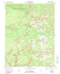
1969 Map of Danese
USGS Topo · Published 1991About this map
Babcock State Park dominates the northern reaches of this Fayette County survey, where the Chesapeake and Ohio railroad corridor traces the deep incision of Glade Creek. The landscape reveals a complex industrial history of extraction, with numerous Strip Mines and Mines Air Shafts peppered across the ridges, particularly around the settlements of Pittman and Landisburg. These coal operations are supported by infrastructure like the Conveyors and Tipples that connect the mountain workings to the rail lines below.
Find a feature on this map
64 named features on this map. Tap any name to fly to it.
Don’t see what you’re looking for? This feature index may not catch every label — zoom into the map to look around manually.
Map Details
Editions of this 1969 Danese Map
3 editions found
Other maps of this area

1887 · Hinton
USGS Topo · 1:125,000

1889 · Nicholas
USGS Topo · 1:125,000

1891 · Nicholas
USGS Topo · 1:125,000

1891 · Raleigh
USGS Topo · 1:125,000

1892 · Hinton
USGS Topo · 1:125,000

1897 · Kanawha Falls
USGS Topo · 1:125,000

1897 · Raleigh
USGS Topo · 1:125,000

1900 · Kanawha Falls
USGS Topo · 1:125,000

1901 · Nicholas
USGS Topo · 1:125,000

1901 · Kanawha Falls
USGS Topo · 1:125,000