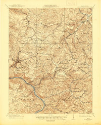
1915 Map of Meadow Creek
USGS Topo · Published 1945About this map
Sewell Mountain and Big Sewell Mountain dominate this Appalachian terrain, where steep ridges and deep-cut branches define the early 20th-century landscape of Fayette, Greenbrier, Raleigh, and Summers counties. The mapping reveals a high density of rural schoolhouses and small settlements that anchored these hillsides before modern consolidation, including Hillside School, Pine Grove School, and Rock of Ages School. The New River carves through the southwestern corner, flanked by the Chesapeake and Ohio railway and settlements like Sandstone and New Richmond. Further north, the timber and coal industry era is visible through Rainelle and rail sidings like Youngs Siding and Quinwood Siding. This survey provides a distinct look at the network of post offices such as Layland PO and Clute PO, alongside local landmarks like Green Sulphur Springs and Meadowbridge, preserving the locations of vanished community hubs and family-named knobs.
Find a feature on this map
129 named features on this map. Tap any name to fly to it.
Don’t see what you’re looking for? This feature index may not catch every label — zoom into the map to look around manually.
Map Details
Editions of this 1915 Meadow Creek Map
3 editions found

Other maps of this area

1887 · Hinton
USGS Topo · 1:125,000

1889 · Nicholas
USGS Topo · 1:125,000

1891 · Nicholas
USGS Topo · 1:125,000

1891 · Raleigh
USGS Topo · 1:125,000

1892 · Hinton
USGS Topo · 1:125,000

1897 · Kanawha Falls
USGS Topo · 1:125,000

1897 · Raleigh
USGS Topo · 1:125,000

1900 · Kanawha Falls
USGS Topo · 1:125,000

1901 · Nicholas
USGS Topo · 1:125,000

1901 · Kanawha Falls
USGS Topo · 1:125,000