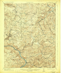
1915 Map of Meadow Creek
USGS Topo · Published 1931About this map
Sewell Mountain dominates this 1912 survey of the West Virginia highlands, where a dense network of mountain schools and small settlements reflects the rural character of Fayette, Greenbrier, and Summers counties. The mapping reveals a region defined by its timber and coal transport, anchored by the Sewell Valley RR and the Chesapeake and Ohio RR. From the industrial center at Rainelle to the remote Layland PO, the terrain is marked by dozens of community landmarks like Rock of Ages School and Bachelors Hall School. Along the New River, the survey captures the natural landmark of Sandstone Falls before the river cuts through the deep gorge. Local commerce is evident in the presence of established post offices at Clute PO and Lawton PO, alongside the healing waters of Green Sulphur Springs nestled in the southern valley.
Find a feature on this map
139 named features on this map. Tap any name to fly to it.
Don’t see what you’re looking for? This feature index may not catch every label — zoom into the map to look around manually.
Map Details
Editions of this 1915 Meadow Creek Map
3 editions found

Other maps of this area

1887 · Hinton
USGS Topo · 1:125,000

1889 · Nicholas
USGS Topo · 1:125,000

1891 · Nicholas
USGS Topo · 1:125,000

1891 · Raleigh
USGS Topo · 1:125,000

1892 · Hinton
USGS Topo · 1:125,000

1897 · Kanawha Falls
USGS Topo · 1:125,000

1897 · Raleigh
USGS Topo · 1:125,000

1900 · Kanawha Falls
USGS Topo · 1:125,000

1901 · Nicholas
USGS Topo · 1:125,000

1901 · Kanawha Falls
USGS Topo · 1:125,000