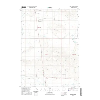
2015 Map of Daniel Junction
USGS Topo · Published 2015About this map
Bronx and Daniel Junction anchor this high-plains landscape in Sublette County, where the Green River meanders through the western half of the map. The terrain is defined by its water management and ranching legacy, featuring a series of catchments including Angus Reservoir, Lauzer Fish Pond Reservoir, and Kitchen Reservoir. These features reflect the area's agricultural development on the high plateau east of the river. The topography shifts from the level expanses of Forty Rod Flat toward the prominent rising of Cora Butte to the southeast. Historical infrastructure is visible at the Old Warren Bridge crossing, while a modern network of seasonal paths like Snowmobile Ln and Snowshoe Trl crisscross the northern range. The map documents a specific mix of traditional cattle ranching geography and modern recreational access, evidenced by the numerous specialized lanes such as Kitchen Ranch Rd and Stone Arrow Trl.
Find a feature on this map
41 named features on this map. Tap any name to fly to it.
Don’t see what you’re looking for? This feature index may not catch every label — zoom into the map to look around manually.
Map Details
Editions of this 2015 Daniel Junction Map
This is the sole edition of this map. No revisions or reprints were ever made.
Other maps of this area

1907 · Gros Ventre
USGS Topo · 1:125,000

1909 · Fremont Peak
USGS Topo · 1:125,000

1910 · Gros Ventre
USGS Topo · 1:125,000

1939 · Big Piney
USGS Topo · 1:125,000

1942 · Big Piney
USGS Topo · 1:125,000

1955 · Driggs
USGS Topo · 1:250,000

1955 · Preston
USGS Topo · 1:250,000

1955 · Thermopolis
USGS Topo · 1:250,000

1955 · Lander
USGS Topo · 1:250,000

1958 · Driggs
USGS Topo · 1:250,000