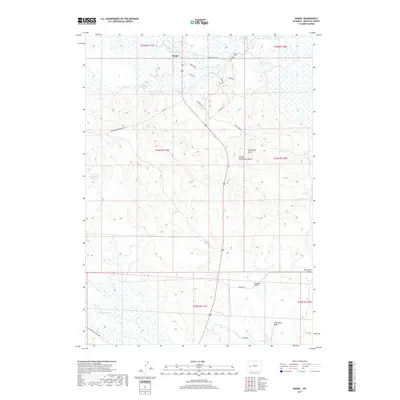
2017 Map of Daniel
USGS Topo · Published 2017About this map
Daniel serves as the focal point of this western Wyoming landscape, situated near the confluence of several vital water sources. The settlement's local history is anchored by the Daniel Cem to the north and the prominent geological rise of Daniel Grindstone Butte to the east. The terrain is defined by a series of drainages and reservoirs, including Travelute Reservoir, Ryegrass Reservoir, and Raven Reservoir, which illustrate the critical role of water management in this high-plains environment. A network of rural routes such as McKinley Rd and Cottonwood Ryegrass Rd connect the scattered homesteads and ranching lands. To the south, the topography descends into the Soap Hole Basin, where the Soaphole Bridge spans the local drainage, marking a key crossing point in the regional transport network of Sublette County.
Find a feature on this map
32 named features on this map. Tap any name to fly to it.
Don’t see what you’re looking for? This feature index may not catch every label — zoom into the map to look around manually.
Map Details
Editions of this 2017 Daniel Map
This is the sole edition of this map. No revisions or reprints were ever made.
Other maps of this area

1939 · Big Piney
USGS Topo · 1:125,000

1942 · Big Piney
USGS Topo · 1:125,000

1955 · Preston
USGS Topo · 1:250,000

1955 · Lander
USGS Topo · 1:250,000

1958 · Lander
USGS Topo · 1:250,000

1958 · Preston
USGS Topo · 1:250,000

1961 · Lander
USGS Topo · 1:250,000

1962 · Preston
USGS Topo · 1:250,000

1964 · Mount Airy
USGS Topo · 1:24,000

1964 · Mesa Spring
USGS Topo · 1:24,000