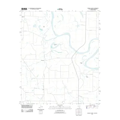
2011 Map of Daniels Chapel
USGS Topo · Published 2011About this map
The Red River snakes through the borderlands of Texas, Arkansas, and Oklahoma, defining the intricate riverine geography of this 2011 survey. Meandering loops and oxbows have created distinctive landforms such as Gano Island and Paul Moore Island, while backwaters like Hurricane Bend Lake and Brushy Lake illustrate the shifting nature of the river channel over time. The settlement pattern is largely rural and dispersed, anchored by the community at Woodstock and the namesake Daniels Chapel.
Find a feature on this map
37 named features on this map. Tap any name to fly to it.
Don’t see what you’re looking for? This feature index may not catch every label — zoom into the map to look around manually.
Map Details
Editions of this 2011 Daniels Chapel Map
This is the sole edition of this map. No revisions or reprints were ever made.
Other maps of this area

1909 · New Boston
USGS Topo · 1:62,500

1930 · Bassett
USGS Topo · 1:62,500

1950 · Redbank
USGS Topo · 1:24,000

1950 · Tom
USGS Topo · 1:24,000

1950 · De Kalb
USGS Topo · 1:24,000

1951 · De Kalb
USGS Topo · 1:24,000

1951 · Tom
USGS Topo · 1:24,000

1951 · Redbank
USGS Topo · 1:24,000

1951 · Arden
USGS Topo · 1:24,000

1951 · Foreman
USGS Topo · 1:24,000