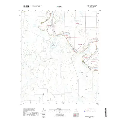
2019 Map of Daniels Chapel
USGS Topo · Published 2019About this map
The Red River snakes through the borderlands of Northeast Texas and Southwest Arkansas, defining a landscape of shifting channels and low-lying wetlands. Near the settlement of Daniels Chapel, the river's meandering path has carved out distinctive landforms like Spanish Bluff and created isolated tracts such as Gano Island and Paul Moore Island. This modern survey details the complex hydrography of the river valley, where numerous tributaries like Mud Cr, Choctaw Bayou, and Meade Cr drain into the main stem and side waters like New Lake. The area's rural character is anchored by small community landmarks, including Spring Branch Cem and Hughes Cem, which provide valuable touchpoints for genealogists researching family ties in Bowie and Little River counties. The transition from the cultivated uplands along Daniels Chapel Rd to the flood-prone timber along the river reflects the enduring influence of the waterway on local land use.
Find a feature on this map
44 named features on this map. Tap any name to fly to it.
Don’t see what you’re looking for? This feature index may not catch every label — zoom into the map to look around manually.
Map Details
Editions of this 2019 Daniels Chapel Map
This is the sole edition of this map. No revisions or reprints were ever made.
Other maps of this area

1909 · New Boston
USGS Topo · 1:62,500

1930 · Bassett
USGS Topo · 1:62,500

1950 · Redbank
USGS Topo · 1:24,000

1950 · Tom
USGS Topo · 1:24,000

1950 · De Kalb
USGS Topo · 1:24,000

1951 · De Kalb
USGS Topo · 1:24,000

1951 · Tom
USGS Topo · 1:24,000

1951 · Redbank
USGS Topo · 1:24,000

1951 · Arden
USGS Topo · 1:24,000

1951 · Foreman
USGS Topo · 1:24,000