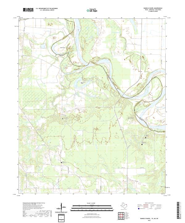
2022 Map of Daniels Chapel
USGS Topo · Published 2022About this map
The Red River winds through this borderland where Texas, Arkansas, and Oklahoma meet, defining a landscape of dynamic waterways and shifting river bends. Along the southern banks in Texas, the terrain is marked by significant riverine features like Spanish Bluff and expansive islands such as Gano Island and Paul Moore Island. These features illustrate the historical impact of the river's migration on local landholdings and boundaries between Bowie County and Little River County.
Find a feature on this map
48 named features on this map. Tap any name to fly to it.
Don’t see what you’re looking for? This feature index may not catch every label — zoom into the map to look around manually.
Map Details
Editions of this 2022 Daniels Chapel Map
This is the sole edition of this map. No revisions or reprints were ever made.
Other maps of this area

1909 · New Boston
USGS Topo · 1:62,500

1930 · Bassett
USGS Topo · 1:62,500

1950 · Redbank
USGS Topo · 1:24,000

1950 · Tom
USGS Topo · 1:24,000

1950 · De Kalb
USGS Topo · 1:24,000

1951 · De Kalb
USGS Topo · 1:24,000

1951 · Tom
USGS Topo · 1:24,000

1951 · Redbank
USGS Topo · 1:24,000

1951 · Arden
USGS Topo · 1:24,000

1951 · Foreman
USGS Topo · 1:24,000