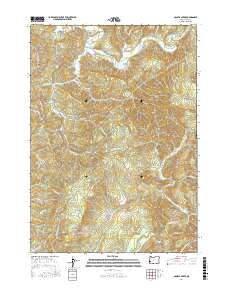
2017 Map of Daniels Creek
USGS Topo · Published 2017About this map
Dellwood occupies a small bend in the South Fork Coos River in this 2017 study of the mountainous interior of Coos County. The river’s winding course dominates the northern portion of the map, featuring uniquely named fishing or swimming spots like Wee House Hole, Contrary Bend, and Myrtle Tree Hole. Connectivity through this dense timberland relies on historic routes such as the Blue Ridge Cutoff and the Landrith Bridge, which provide access to family-named landmarks like Bull Pasture and several springs. In the south, the topography transitions toward the North Fork Coquille River drainage, where the terrain drops sharply at Laverne Falls. The map reveals a landscape defined by industrial logging and forestry management, evidenced by the intricate network of timber roads including Solari Rd and Daniels Creek Rd that lace between the ridges of Blue Ridge.
Find a feature on this map
54 named features on this map. Tap any name to fly to it.
Don’t see what you’re looking for? This feature index may not catch every label — zoom into the map to look around manually.
Map Details
Editions of this 2017 Daniels Creek Map
This is the sole edition of this map. No revisions or reprints were ever made.
Other maps of this area

1896 · Coos Bay
USGS Topo · 1:125,000

1898 · Coos Bay
USGS Topo · 1:125,000

1900 · Coos Bay
USGS Topo · 1:125,000

1928 · Sitkum
USGS Topo · 1:125,000

1942 · Coquille
USGS Topo · 1:62,500

1942 · Coos Bay
USGS Topo · 1:62,500

1945 · Coquille
USGS Topo · 1:62,500

1945 · Coos Bay
USGS Topo · 1:62,500

1954 · Coos Bay
USGS Topo · 1:250,000

1955 · Ivers Peak
USGS Topo · 1:62,500