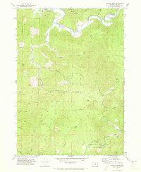
1971 Map of Daniels Creek
USGS Topo · Published 1973About this map
The South Fork Coos River and the North Fork Coquille River define the hydraulic character of this timber-rich region in the Coast Range. In the early 1970s, small settlements like Dellwood and the vicinity of the Coos River Sch near Landrith Bridge served as focal points for the local community. The landscape is heavily structured by logging and resource management, with large tracts dedicated to the Elliott State Forest and the Coos County Forest.
Find a feature on this map
36 named features on this map. Tap any name to fly to it.
Don’t see what you’re looking for? This feature index may not catch every label — zoom into the map to look around manually.
Map Details
Editions of this 1971 Daniels Creek Map
This is the sole edition of this map. No revisions or reprints were ever made.
Other maps of this area

1896 · Coos Bay
USGS Topo · 1:125,000

1898 · Coos Bay
USGS Topo · 1:125,000

1900 · Coos Bay
USGS Topo · 1:125,000

1928 · Sitkum
USGS Topo · 1:125,000

1942 · Coquille
USGS Topo · 1:62,500

1942 · Coos Bay
USGS Topo · 1:62,500

1945 · Coquille
USGS Topo · 1:62,500

1945 · Coos Bay
USGS Topo · 1:62,500

1954 · Coos Bay
USGS Topo · 1:250,000

1955 · Ivers Peak
USGS Topo · 1:62,500