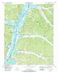
1949 Map of Daniels Landing
USGS Topo · Published 1988About this map
Kentucky Lake dominates this stretch of the Tennessee River, serving as a focal point for the region's mid-century development. Along the riverbanks, numerous landings such as Daniels Landing, Brevards Landing, and Saulpaws Landing mark the historical points of access and river-based commerce. The landscape is characterized by a dense network of hollows, including Hellsneck Hollow and Rabbit Hollow, which drain into the main river channel.
Find a feature on this map
72 named features on this map. Tap any name to fly to it.
Don’t see what you’re looking for? This feature index may not catch every label — zoom into the map to look around manually.
Map Details
Editions of this 1949 Daniels Landing Map
3 editions found
Other maps of this area

1936 · Hurricane Mills
USGS Topo · 1:24,000

1936 · Pine View
USGS Topo · 1:24,000

1936 · Daniels Landing
USGS Topo · 1:24,000

1936 · Chestnut Grove
USGS Topo · 1:24,000

1936 · Jeannette
USGS Topo · 1:24,000

1936 · Sugar Tree
USGS Topo · 1:24,000

1936 · Lobelville
USGS Topo · 1:24,000

1936 · Rockport
USGS Topo · 1:24,000

1936 · Hustburg
USGS Topo · 1:24,000

1949 · Daniels Landing
USGS Topo · 1:24,000