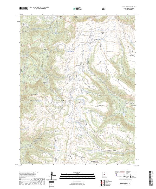
2023 Map of Danish Knoll
USGS Topo · Published 2023About this map
Manti-La Sal National Forest defines this high-altitude landscape in Sanpete County, where an intricate system of water management features highlights the region's agricultural and hydrologic history. The presence of numerous engineered waterways, including the South Ephraim Ditch, Larsen Ditch, and Wasatch Ditch, illustrates a sophisticated approach to directing snowmelt and spring water across the plateau. These ditches link prominent water bodies like Petes Hole Reservoir, New Canyon Reservoir, and the small John August Lake to the surrounding terrain.
Find a feature on this map
82 named features on this map. Tap any name to fly to it.
Don’t see what you’re looking for? This feature index may not catch every label — zoom into the map to look around manually.
Map Details
Editions of this 2023 Danish Knoll Map
This is the sole edition of this map. No revisions or reprints were ever made.
Other maps of this area

1885 · Manti
USGS Topo · 1:250,000

1895 · Manti
USGS Topo · 1:250,000

1922 · Wasatch
USGS Topo · 1:31,680

1956 · Price
USGS Topo · 1:250,000

1960 · Price
USGS Topo · 1:250,000

1962 · Price
USGS Topo · 1:250,000

1965 · Black Mountain
USGS Topo · 1:24,000
1966 · Ferron Reservoir
USGS Topo · 1:24,000

1966 · Spring City
USGS Topo · 1:24,000

1966 · Chester
USGS Topo · 1:24,000