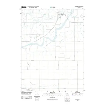
2011 Map of Dannebrog
USGS Topo · Published 2011About this map
The Middle Loup River winds diagonally through this landscape, defining the agricultural and civic layout of the region. The village of Dannebrog sits in the northern reaches, organized around the Dannebrog Post Office and nearby Oak Creek. To the southwest, the town of Cairo serves as another focal point, anchored by the Cairo Post Office and a grid of rural roads. This 2011 survey highlights the managed hydrology of the plains, where Fries Dam and Fries Reservoir provide water storage amidst a network of natural drainages like Big Slough and Dry Creek. The map provides a precise record of cemetery locations, including Oak Ridge Cemetery, and the naming conventions of the road network, ranging from numbered avenues like 6th Ave to family-named routes such as Naper Rd and Odell Rd.
Find a feature on this map
37 named features on this map. Tap any name to fly to it.
Don’t see what you’re looking for? This feature index may not catch every label — zoom into the map to look around manually.
Map Details
Editions of this 2011 Dannebrog Map
This is the sole edition of this map. No revisions or reprints were ever made.
Other maps of this area

1892 · Grand Island
USGS Topo · 1:62,500

1895 · Grand Island
USGS Topo · 1:62,500

1895 · Wood River
USGS Topo · 1:62,500

1896 · Wood River
USGS Topo · 1:125,000

1898 · Grand Island
USGS Topo · 1:125,000

1899 · Loup
USGS Topo · 1:125,000

1899 · St. Paul
USGS Topo · 1:125,000

1953 · Dannebrog
USGS Topo · 1:24,000

1953 · Boelus
USGS Topo · 1:24,000

1953 · Farwell
USGS Topo · 1:24,000