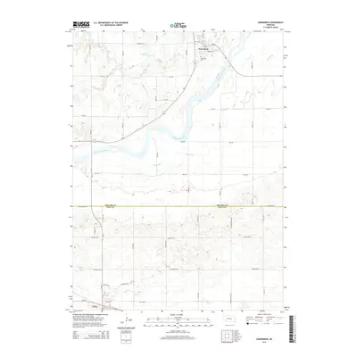
2014 Map of Dannebrog
USGS Topo · Published 2014About this map
The Middle Loup River winds diagonally across this Nebraska landscape, defining the character of the region between Dannebrog in the north and Cairo at the southwestern edge. The map captures a transitional prairie environment where natural drainage features like Big Slough, Oak Cr, and Dry Cr intersect with an orderly grid of section roads. Cultural landmarks such as Oak Ridge Cem near Dannebrog and the Fries Reservoir provide points of interest for local historians and genealogists. The terrain is notably marked by the boundary between Howard County and Hall County, showcasing how historical political lines follow the geography of the central plains. Residential developments like those along Birdie Blvd and Hillside Dr near Cairo contrast with the more traditional rural layout of the northern townships.
Find a feature on this map
41 named features on this map. Tap any name to fly to it.
Don’t see what you’re looking for? This feature index may not catch every label — zoom into the map to look around manually.
Map Details
Editions of this 2014 Dannebrog Map
This is the sole edition of this map. No revisions or reprints were ever made.
Other maps of this area

1892 · Grand Island
USGS Topo · 1:62,500

1895 · Grand Island
USGS Topo · 1:62,500

1895 · Wood River
USGS Topo · 1:62,500

1896 · Wood River
USGS Topo · 1:125,000

1898 · Grand Island
USGS Topo · 1:125,000

1899 · Loup
USGS Topo · 1:125,000

1899 · St. Paul
USGS Topo · 1:125,000

1953 · Dannebrog
USGS Topo · 1:24,000

1953 · Boelus
USGS Topo · 1:24,000

1953 · Farwell
USGS Topo · 1:24,000