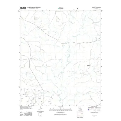
2012 Map of Danville
USGS Topo · Published 2012About this map
The Dugdemona River and its companion, the Little Dugdemona River, define the hydrology of this Bienville Parish landscape. At the center of the local industry is the Danville Gas Field, surrounded by a web of parish roads including Danville Rd and Evergreen Rd. Small settlements like Danville, Loe, Shady, and Evergreen serve as the primary human hubs, often located near ancestral sites such as Danville Cem and McDonald Cem. The terrain is deeply carved by a network of drainage systems, including Fouse Bayou, Muddy Cr, and the descriptively named Burnt Cabin Cr. This survey illustrates the persistence of rural communities and extractive industries in northern Louisiana during the early 21st century, where family-named landmarks like Babers Rd and Watkins Rd indicate long-standing local ties.
Find a feature on this map
68 named features on this map. Tap any name to fly to it.
Don’t see what you’re looking for? This feature index may not catch every label — zoom into the map to look around manually.
Map Details
Editions of this 2012 Danville Map
This is the sole edition of this map. No revisions or reprints were ever made.
Other maps of this area

1947 · Goldonna
USGS Topo · 1:62,500

1947 · Bienville
USGS Topo · 1:62,500

1949 · Bienville
USGS Topo · 1:62,500

1949 · Jonesboro
USGS Topo · 1:62,500

1950 · Jonesboro
USGS Topo · 1:62,500

1953 · Hodge
USGS Topo · 1:62,500

1955 · Shreveport
USGS Topo · 1:250,000

1956 · Shreveport
USGS Topo · 1:250,000

1957 · Goldonna
USGS Topo · 1:62,500

1984 · Shreveport
USGS Topo · 1:250,000