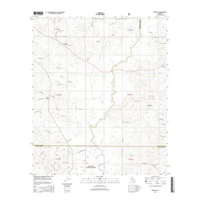
2015 Map of Danville
USGS Topo · Published 2015About this map
The Dugdemona River meanders through the central lowlands of this part of North Louisiana, defining the border between Bienville and Jackson Parishes. To the south, the landscape is preserved within the Kisatchie National Forest, where the terrain is drained by tributaries like Lick Creek and Boggy Cr. Small rural settlements such as Danville, Loe, Shady, and Evergreen are scattered across the higher ground, connected by a network of parish roads. Local history and genealogy are anchored by landmarks like the Danville Cem and McDonald Cem. The map illustrates a typical timber-and-agricultural interior, where drainage patterns from Muddy Cr and Fouse Bayou dictate the placement of early homesteads and roadbeds. These waterways and the expansive wetlands surrounding Horner Lake reflect the hydrological character of the region before modern development altered local drainage.
Find a feature on this map
77 named features on this map. Tap any name to fly to it.
Don’t see what you’re looking for? This feature index may not catch every label — zoom into the map to look around manually.
Map Details
Editions of this 2015 Danville Map
This is the sole edition of this map. No revisions or reprints were ever made.
Other maps of this area

1947 · Goldonna
USGS Topo · 1:62,500

1947 · Bienville
USGS Topo · 1:62,500

1949 · Bienville
USGS Topo · 1:62,500

1949 · Jonesboro
USGS Topo · 1:62,500

1950 · Jonesboro
USGS Topo · 1:62,500

1953 · Hodge
USGS Topo · 1:62,500

1955 · Shreveport
USGS Topo · 1:250,000

1956 · Shreveport
USGS Topo · 1:250,000

1957 · Goldonna
USGS Topo · 1:62,500

1984 · Shreveport
USGS Topo · 1:250,000