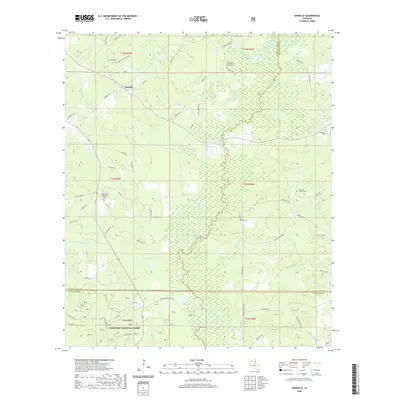
2020 Map of Danville
USGS Topo · Published 2020About this map
The settlement of Danville anchors this North Louisiana landscape where the borders of Bienville, Jackson, and Winn Parishes meet. This area is defined by the wandering course of the Dudemona River and its sister waterway, the Little Dudemona River, which weave through a network of creeks and bayous including Fouse Bayou and Muddy Cr. The southern portion of the map transitions into the protected woodlands of the Kisatchie National Forest, showing the intersection of timber conservation and local rural development.
Find a feature on this map
69 named features on this map. Tap any name to fly to it.
Don’t see what you’re looking for? This feature index may not catch every label — zoom into the map to look around manually.
Map Details
Editions of this 2020 Danville Map
This is the sole edition of this map. No revisions or reprints were ever made.
Other maps of this area

1947 · Goldonna
USGS Topo · 1:62,500

1947 · Bienville
USGS Topo · 1:62,500

1949 · Bienville
USGS Topo · 1:62,500

1949 · Jonesboro
USGS Topo · 1:62,500

1950 · Jonesboro
USGS Topo · 1:62,500

1953 · Hodge
USGS Topo · 1:62,500

1955 · Shreveport
USGS Topo · 1:250,000

1956 · Shreveport
USGS Topo · 1:250,000

1957 · Goldonna
USGS Topo · 1:62,500

1984 · Shreveport
USGS Topo · 1:250,000