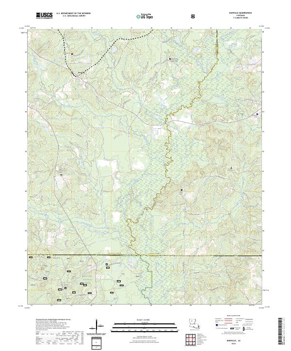
2024 Map of Danville
USGS Topo · Published 2024About this map
The Dugdemona River and its intricate drainage network define the topography where Bienville, Jackson, and Winn parishes meet. This landscape, dominated by the timberlands of the Kisatchie National Forest, is marked by a history of small-scale settlement and rural industry. The presence of Old Sawmill Rd and Sawmill Rd near the community of Danville indicates the long-standing importance of the lumber economy to this corner of north-central Louisiana.
Find a feature on this map
72 named features on this map. Tap any name to fly to it.
Don’t see what you’re looking for? This feature index may not catch every label — zoom into the map to look around manually.
Map Details
Editions of this 2024 Danville Map
This is the sole edition of this map. No revisions or reprints were ever made.
Other maps of this area

1947 · Goldonna
USGS Topo · 1:62,500

1947 · Bienville
USGS Topo · 1:62,500

1949 · Bienville
USGS Topo · 1:62,500

1949 · Jonesboro
USGS Topo · 1:62,500

1950 · Jonesboro
USGS Topo · 1:62,500

1953 · Hodge
USGS Topo · 1:62,500

1955 · Shreveport
USGS Topo · 1:250,000

1956 · Shreveport
USGS Topo · 1:250,000

1957 · Goldonna
USGS Topo · 1:62,500

1984 · Shreveport
USGS Topo · 1:250,000