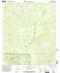
2003 Map of Danville
USGS Topo · Published 2005About this map
The Dugdemona River and its complex network of tributaries define this landscape at the intersection of Bienville, Jackson, and Winn Parishes. This 2003 revision reveals the northern reaches of the Kisatchie National Forest, where the terrain is marked by timberlands and a dense hydrographic system including Little Dugdemona River and Muddy Creek. The small settlement of Danville is the primary hub of activity, surrounded by several rural Cem sites and family-named landmarks like Horner Lake.
Find a feature on this map
22 named features on this map. Tap any name to fly to it.
Don’t see what you’re looking for? This feature index may not catch every label — zoom into the map to look around manually.
Map Details
Editions of this 2003 Danville Map
This is the sole edition of this map. No revisions or reprints were ever made.
Other maps of this area

1947 · Goldonna
USGS Topo · 1:62,500

1947 · Bienville
USGS Topo · 1:62,500

1949 · Bienville
USGS Topo · 1:62,500

1949 · Jonesboro
USGS Topo · 1:62,500

1950 · Jonesboro
USGS Topo · 1:62,500

1953 · Hodge
USGS Topo · 1:62,500

1955 · Shreveport
USGS Topo · 1:250,000

1956 · Shreveport
USGS Topo · 1:250,000

1957 · Goldonna
USGS Topo · 1:62,500

1984 · Shreveport
USGS Topo · 1:250,000