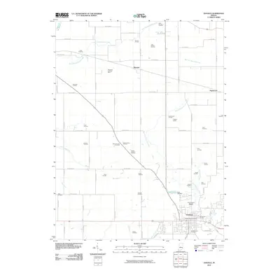
2010 Map of Danville
USGS Topo · Published 2010About this map
Danville serves as the focal point of this central Indiana landscape, where the town's expanding residential grid meets a dense network of family and community burying grounds. The map reveals a remarkable concentration of cemeteries, many bearing local family names like the Trotter Cemetery, Devenport Cemetery, and Gentry Cemetery. These sites are scattered across a terrain defined by the drainage of East Fork Big Walnut Creek and West Fork White Lick Creek, illustrating the early patterns of rural settlement before modern development began to fill the spaces between the county seat and smaller hamlets like Montclair and Maplewood. Regional infrastructure is evidenced by the presence of small aviation sites such as Temple Airport and the Reynolds Landing Strip, alongside water management at Stout Lake. For researchers, the sheer density of named cemeteries, from Saint Augustine Memorial Gardens to the Primitive Baptist Cemetery, offers an unusually detailed spatial record of the area's genealogical history.
Find a feature on this map
56 named features on this map. Tap any name to fly to it.
Don’t see what you’re looking for? This feature index may not catch every label — zoom into the map to look around manually.
Map Details
Editions of this 2010 Danville Map
This is the sole edition of this map. No revisions or reprints were ever made.
Other maps of this area

1953 · Clayton
USGS Topo · 1:24,000

1953 · Fayette
USGS Topo · 1:24,000

1953 · Lizton
USGS Topo · 1:24,000

1953 · Danville
USGS Topo · 1:24,000

1953 · Brownsburg
USGS Topo · 1:24,000

1953 · Plainfield
USGS Topo · 1:24,000

1953 · Indianapolis
USGS Topo · 1:250,000

1956 · Indianapolis
USGS Topo · 1:250,000

1957 · Indianapolis
USGS Topo · 1:250,000

1957 · New Ross
USGS Topo · 1:24,000