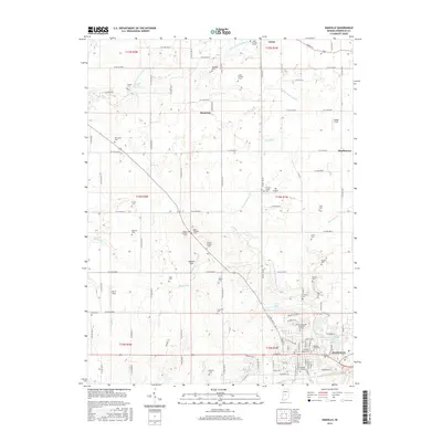
2016 Map of Danville
USGS Topo · Published 2016About this map
Danville serves as the focal point of this Hendricks County survey, anchored by its historic core near W Main St and E Main St. The surrounding landscape is a complex network of agricultural plots and rural cemeteries, reflecting generations of settlement along the watershed of W Fork White Lick Cr. Local family names are preserved throughout the township in sites like Pritchett Cem, Devenport Cem, and Nichols Cem, while smaller communities such as Lizton and Montclair mark the intersections of the gridded county road system. The map reveals the local hydrology through features like Eads Ditch and Ramp Run, which feed into the larger creek systems. Cultural and recreational landmarks, including JR's Airport and the Danville Conservation Club Lake, illustrate the modern character of this central Indiana landscape.
Find a feature on this map
76 named features on this map. Tap any name to fly to it.
Don’t see what you’re looking for? This feature index may not catch every label — zoom into the map to look around manually.
Map Details
Editions of this 2016 Danville Map
This is the sole edition of this map. No revisions or reprints were ever made.
Other maps of this area

1953 · Clayton
USGS Topo · 1:24,000

1953 · Fayette
USGS Topo · 1:24,000

1953 · Lizton
USGS Topo · 1:24,000

1953 · Danville
USGS Topo · 1:24,000

1953 · Brownsburg
USGS Topo · 1:24,000

1953 · Plainfield
USGS Topo · 1:24,000

1953 · Indianapolis
USGS Topo · 1:250,000

1956 · Indianapolis
USGS Topo · 1:250,000

1957 · Indianapolis
USGS Topo · 1:250,000

1957 · New Ross
USGS Topo · 1:24,000