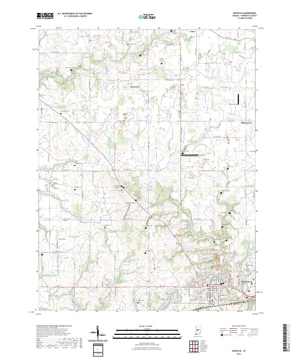
2022 Map of Danville
USGS Topo · Published 2022About this map
Danville serves as the focal point of this central Indiana landscape, anchored by the Hendricks County Courthouse and its surrounding street grid. The settlement pattern here reflects a deeply rooted agricultural and family history, evidenced by the high density of small burial grounds that dot the countryside, including the Rawlings Family Cem, Noland Number 2 Cem, and Tinder Cem. Small rural centers such as Lizton, Montclair, and Maplewood are linked by a precise grid of county roads, while the terrain is carved by the meandering paths of West Fork White Lick Creek and E Fork Big Walnut Cr. Notable landmarks such as JR's Airport and the Danville Conservation Club Lake suggest the area's mix of private aviation and community recreation amidst the farmland.
Find a feature on this map
88 named features on this map. Tap any name to fly to it.
Don’t see what you’re looking for? This feature index may not catch every label — zoom into the map to look around manually.
Map Details
Editions of this 2022 Danville Map
This is the sole edition of this map. No revisions or reprints were ever made.
Other maps of this area

1953 · Clayton
USGS Topo · 1:24,000

1953 · Fayette
USGS Topo · 1:24,000

1953 · Lizton
USGS Topo · 1:24,000

1953 · Danville
USGS Topo · 1:24,000

1953 · Brownsburg
USGS Topo · 1:24,000

1953 · Plainfield
USGS Topo · 1:24,000

1953 · Indianapolis
USGS Topo · 1:250,000

1956 · Indianapolis
USGS Topo · 1:250,000

1957 · Indianapolis
USGS Topo · 1:250,000

1957 · New Ross
USGS Topo · 1:24,000