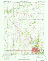
1970 Map of Danville
USGS Topo · Published 1972About this map
The county seat of Danville anchors this West-Central Indiana landscape, appearing here as it was surveyed in the early 1970s. The town's urban grid is well-established, featuring St Augustine Ch, the local High Sch, and the Fairgrounds on its eastern edge. Two major rail corridors define the local geography: the Penn Central line passing directly through Danville and the Baltimore and Ohio tracks further north, which served the small settlement of Montclair.
Find a feature on this map
51 named features on this map. Tap any name to fly to it.
Don’t see what you’re looking for? This feature index may not catch every label — zoom into the map to look around manually.
Map Details
Editions of this 1970 Danville Map
This is the sole edition of this map. No revisions or reprints were ever made.
Other maps of this area

1953 · Clayton
USGS Topo · 1:24,000

1953 · Fayette
USGS Topo · 1:24,000

1953 · Lizton
USGS Topo · 1:24,000

1953 · Danville
USGS Topo · 1:24,000

1953 · Brownsburg
USGS Topo · 1:24,000

1953 · Plainfield
USGS Topo · 1:24,000

1953 · Indianapolis
USGS Topo · 1:250,000

1956 · Indianapolis
USGS Topo · 1:250,000

1957 · Indianapolis
USGS Topo · 1:250,000

1957 · New Ross
USGS Topo · 1:24,000