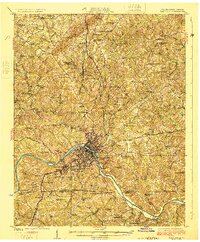
1925 Map of Danville
USGS Topo · Published 1925About this map
The industrial and residential growth of Danville dominates this mid-1920s survey, showing the city's complex relationship with the Dan River and the Southern Railway. To the west, the mill town of Schoolfield appears as a distinct planned community, flanked by neighborhoods like Bannerville, Almagro, and Newtown. This era represents a peak for the local textile economy, evidenced by the dense grid of worker housing and proximity to the rail lines that served the factories.
Find a feature on this map
93 named features on this map. Tap any name to fly to it.
Don’t see what you’re looking for? This feature index may not catch every label — zoom into the map to look around manually.
Map Details
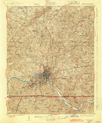
Editions of this 1925 Danville Map
3 editions found
Other maps of this area

1921 · Chatham
USGS Topo · 1:48,000

1922 · Callands
USGS Topo · 1:48,000

1923 · Danville
USGS Topo · 1:48,000

1923 · Chatham
USGS Topo · 1:62,500

1924 · Draper
USGS Topo · 1:48,000

1924 · Callands
USGS Topo · 1:62,500

1925 · Danville
USGS Topo · 1:62,500

1926 · Draper
USGS Topo · 1:62,500

1944 · Draper
USGS Topo · 1:62,500

1944 · Callands
USGS Topo · 1:62,500