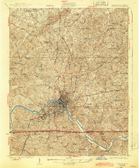
1925 Map of Danville
USGS Topo · Published 1944About this map
The Dan River serves as the industrial and geographic anchor for this 1920s landscape, where the textile manufacturing hub of Schoolfield and the neighboring community of Bannerville define the river's southern bank. This survey, completed in 1923, documents the corridor before modern sprawl, showing the intricate network of the Southern railroad and local waypoints like Stokesland and Ringgold. To the north, the terrain is dominated by the prominent ridge of White Oak Mountain, while the surrounding countryside is dotted with a dense distribution of rural schools and churches, such as the Lovelace Hall School and Mt Pleasant Church.
Find a feature on this map
79 named features on this map. Tap any name to fly to it.
Don’t see what you’re looking for? This feature index may not catch every label — zoom into the map to look around manually.
Map Details
Editions of this 1925 Danville Map
3 editions found
Other maps of this area

1921 · Chatham
USGS Topo · 1:48,000

1922 · Callands
USGS Topo · 1:48,000

1923 · Danville
USGS Topo · 1:48,000

1923 · Chatham
USGS Topo · 1:62,500

1924 · Draper
USGS Topo · 1:48,000

1924 · Callands
USGS Topo · 1:62,500

1925 · Danville
USGS Topo · 1:62,500

1926 · Draper
USGS Topo · 1:62,500

1944 · Draper
USGS Topo · 1:62,500

1944 · Callands
USGS Topo · 1:62,500