
1965 Map of Danville
USGS Topo · Published 1966About this map
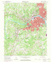
The Dan River carves through this mid-1960s landscape, separating the urban core of Danville from the expanding suburbs in Westover Hills and Lansbury. The map documents a significant era of institutional growth, marking the campuses of Averett College and Stratford College, alongside specialized facilities like the Danville Technical Institute (VPI) and the Danville River Textile Sch. The industrial and residential character of south Danville is evident in the layout of Schoolfield and the neighborhood of Almagro, both situated near the Southern railroad lines.
Find a feature on this map
84 named features on this map. Tap any name to fly to it.
Don’t see what you’re looking for? This feature index may not catch every label — zoom into the map to look around manually.
Map Details
Editions of this 1965 Danville Map
4 editions found
Other maps of this area

1923 · Danville
USGS Topo · 1:48,000

1924 · Draper
USGS Topo · 1:48,000

1925 · Danville
USGS Topo · 1:62,500

1926 · Draper
USGS Topo · 1:62,500

1944 · Draper
USGS Topo · 1:62,500

1953 · Greensboro
USGS Topo · 1:250,000

1954 · Greensboro
USGS Topo · 1:250,000

1962 · Greensboro
USGS Topo · 1:250,000

1964 · Mount Hermon
USGS Topo · 1:24,000
1964 · Blairs
USGS Topo · 1:24,000