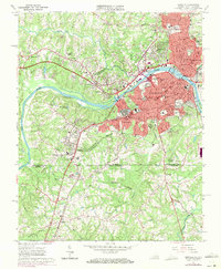
1965 Map of Danville
USGS Topo · Published 1971About this map
The industrial and academic landscape of south-central Virginia comes into focus along the Dan River in this mid-1960s study. Danville serves as the dominant hub, showcasing a dense network of textile and manufacturing infrastructure near the Filtration Plant and Powerplant. Education is a primary theme of the city's mid-century growth, featuring prominent institutions like Averett College, Stratford College, and the Danville Community College (VPI).
Find a feature on this map
85 named features on this map. Tap any name to fly to it.
Don’t see what you’re looking for? This feature index may not catch every label — zoom into the map to look around manually.
Map Details
Editions of this 1965 Danville Map
4 editions found

Other maps of this area

1923 · Danville
USGS Topo · 1:48,000

1924 · Draper
USGS Topo · 1:48,000

1925 · Danville
USGS Topo · 1:62,500

1926 · Draper
USGS Topo · 1:62,500

1944 · Draper
USGS Topo · 1:62,500

1953 · Greensboro
USGS Topo · 1:250,000

1954 · Greensboro
USGS Topo · 1:250,000

1962 · Greensboro
USGS Topo · 1:250,000

1964 · Mount Hermon
USGS Topo · 1:24,000
1964 · Blairs
USGS Topo · 1:24,000