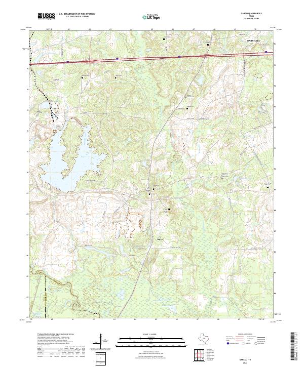
2022 Map of Darco
USGS Topo · Published 2022About this map
Darco sits at the heart of this landscape, where the southern reaches of Marshall give way to a network of creeks and family cemeteries. The terrain is defined by the winding course of the Sabine River along the southern boundary, surrounded by a complex system of wetlands including Long Slough, Round Lake, and the Hendricks Lakes. This area of East Texas is notable for its dense concentration of historical burial grounds, such as the Saint Marys Baptist Church Cem and the Grange Hall Cem, which often represent the only remaining markers of early rural communities. Modern infrastructure like the Mine Haul Rd and various rural routes such as FM 2625 and FM 3251 intersect with natural features like Roseborough Springs, illustrating the region's long-standing connection between its water resources and local industrial and residential development.
Find a feature on this map
63 named features on this map. Tap any name to fly to it.
Don’t see what you’re looking for? This feature index may not catch every label — zoom into the map to look around manually.
Map Details
Editions of this 2022 Darco Map
This is the sole edition of this map. No revisions or reprints were ever made.
Other maps of this area

1956 · Tyler
USGS Topo · 1:250,000

1958 · Darco
USGS Topo · 1:62,500

1958 · Tatum
USGS Topo · 1:62,500

1961 · Hallsville
USGS Topo · 1:24,000

1962 · Marshall West
USGS Topo · 1:24,000

1962 · Marshall East
USGS Topo · 1:24,000

1983 · Grand Bluff
USGS Topo · 1:24,000

1983 · Tatum
USGS Topo · 1:24,000

1983 · Harris Chapel
USGS Topo · 1:24,000

1983 · Easton
USGS Topo · 1:24,000