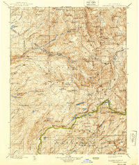
1898 Map of Dardanelles
USGS Topo · Published 1939About this map
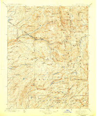
Middle Fork Stanislaus River and its intricate drainage system define this High Sierra landscape during the late nineteenth-century surveying period. The map details a transition from the Stanislaus National Forest into the northern reaches of Yosemite National Park, capturing the region as it was understood before modern infrastructure. Travel through these granite heights is marked by the Old Sonora Road and high-altitude crossings like Sonora Pass and Bond Pass.
Find a feature on this map
154 named features on this map. Tap any name to fly to it.
Don’t see what you’re looking for? This feature index may not catch every label — zoom into the map to look around manually.
Map Details
Editions of this 1898 Dardanelles Map
8 editions found

Other maps of this area

1889 · Pyramid Peak
USGS Topo · 1:125,000

1889 · Markleeville
USGS Topo · 1:125,000

1891 · Markleeville
USGS Topo · 1:125,000

1891 · Big Trees
USGS Topo · 1:125,000

1891 · Pyramid Peak
USGS Topo · 1:125,000

1891 · Wellington
USGS Topo · 1:125,000

1893 · Markleeville
USGS Topo · 1:125,000

1893 · Sonora
USGS Topo · 1:125,000

1893 · Wellington
USGS Topo · 1:125,000

1894 · Big Trees
USGS Topo · 1:125,000