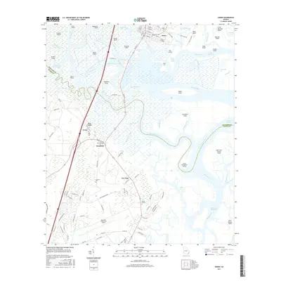
2017 Map of Darien
USGS Topo · Published 2017About this map
Darien sits at the northern edge of a sprawling delta where the Altamaha River breaks into a complex network of channels, including the Champney River and Butler River. This coastal landscape is defined by its low-lying tidal marshes and a series of significant islands like Butler Island, Champney Island, and Broughton Island. The map reveals a deep layering of local history through its cemeteries, including the Old Slave Cem near Broadfield and the Freedman Cem further south. These sites, along with settlements like Evelyn and New Hope, suggest a legacy of plantation-era land use and post-emancipation communities. The southern portion of the map transitions toward more contemporary infrastructure, anchored by the Brunswick Golden Isles Airport and the residential corridors of Methory Gardens, while the eastern reaches trace the Intracoastal Waterway through Buttermilk Sound toward Saint Simons Island.
Find a feature on this map
117 named features on this map. Tap any name to fly to it.
Don’t see what you’re looking for? This feature index may not catch every label — zoom into the map to look around manually.
Map Details
Editions of this 2017 Darien Map
This is the sole edition of this map. No revisions or reprints were ever made.
Other maps of this area

1918 · Everett City
USGS Topo · 1:62,500

1918 · Bladen
USGS Topo · 1:62,500

1920 · Everett City
USGS Topo · 1:62,500

1921 · Darien
USGS Topo · 1:62,500

1939 · Bladen
USGS Topo · 1:62,500

1944 · Everett City
USGS Topo · 1:62,500

1945 · Brunswick
USGS Topo · 1:62,500

1946 · Brunswick
USGS Topo · 1:250,000

1948 · Brunswick
USGS Topo · 1:250,000

1954 · Altamaha Sound
USGS Topo · 1:24,000