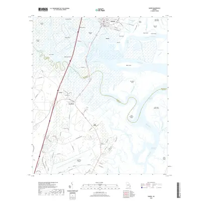
2020 Map of Darien
USGS Topo · Published 2020About this map
The Mcintosh County Courthouse anchors the historic riverfront of Darien, overlooking a dense network of coastal waterways where the Altamaha River meets the sea. This landscape is defined by its low-lying islands, including Butler Island, Champney Island, and Rhetts Island, which are separated by a complex system of cuts and reaches such as Generals Cut and Pico Cut. The mapping reveals a distinct pattern of historical occupation, particularly through its cemeteries which provide a window into the area's social history. Sites such as the Old Slave Cem and Freedman Cem reflect the legacy of the plantation era and the subsequent development of communities like Broadfield and Evelyn. To the south, the presence of the Brunswick Golden Isles Airport and modern thoroughfares like Harry Driggers Blvd show the modern expansion of the region toward the Intracoastal Waterway and the marshes surrounding Little Saint Simons Island.
Find a feature on this map
123 named features on this map. Tap any name to fly to it.
Don’t see what you’re looking for? This feature index may not catch every label — zoom into the map to look around manually.
Map Details
Editions of this 2020 Darien Map
This is the sole edition of this map. No revisions or reprints were ever made.
Other maps of this area

1918 · Everett City
USGS Topo · 1:62,500

1918 · Bladen
USGS Topo · 1:62,500

1920 · Everett City
USGS Topo · 1:62,500

1921 · Darien
USGS Topo · 1:62,500

1939 · Bladen
USGS Topo · 1:62,500

1944 · Everett City
USGS Topo · 1:62,500

1945 · Brunswick
USGS Topo · 1:62,500

1946 · Brunswick
USGS Topo · 1:250,000

1948 · Brunswick
USGS Topo · 1:250,000

1954 · Altamaha Sound
USGS Topo · 1:24,000