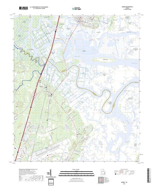
2024 Map of Darien
USGS Topo · Published 2024About this map
The low-lying estuarine landscape of the Georgia coast is dominated by the complex delta where the Altamaha River meets the Atlantic. At the heart of this network sits Darien, the seat of McIntosh County, situated along the north bank of the Darien River. The surrounding terrain is a maze of tidewater passages and marshland islands, including Butler Island, Champney Island, and Rhetts Island. Notable man-made modifications to the natural hydrology appear in the form of historical cuts like Pico Cut and Threemile Cut, as well as the significant Brunswick-Altamaha Canal running south toward the Brunswick Golden Isles Airport.
Find a feature on this map
119 named features on this map. Tap any name to fly to it.
Don’t see what you’re looking for? This feature index may not catch every label — zoom into the map to look around manually.
Map Details
Editions of this 2024 Darien Map
This is the sole edition of this map. No revisions or reprints were ever made.
Other maps of this area

1918 · Everett City
USGS Topo · 1:62,500

1918 · Bladen
USGS Topo · 1:62,500

1920 · Everett City
USGS Topo · 1:62,500

1921 · Darien
USGS Topo · 1:62,500

1939 · Bladen
USGS Topo · 1:62,500

1944 · Everett City
USGS Topo · 1:62,500

1945 · Brunswick
USGS Topo · 1:62,500

1946 · Brunswick
USGS Topo · 1:250,000

1948 · Brunswick
USGS Topo · 1:250,000

1954 · Altamaha Sound
USGS Topo · 1:24,000