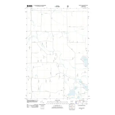
2011 Map of Dark Lake
USGS Topo · Published 2011About this map
Dark River meanders south through this Saint Louis County landscape, anchoring a complex system of waterways and timber-access routes. The terrain is defined by its glacial hydrology, featuring a network of interconnected lakes and streams such as Tremblon Lake, Knuckey Lake, and the winding Sturgeon River in the northwest. Several rural thoroughfares like Heino Rd and Graham Rd segment the territory, illustrating the modern management of this forested region by the U.S. Forest Service. Near the southern boundary, Camp Four Lake and Dark Lake sit amidst a concentration of water bodies including Clear Lake. This 2011 survey documents the established road network, from Lonesome Polecat Rd to Lake Leander Rd, providing a clear record of land use and accessibility in the Minnesota Northwoods at the start of the 21st century.
Find a feature on this map
25 named features on this map. Tap any name to fly to it.
Don’t see what you’re looking for? This feature index may not catch every label — zoom into the map to look around manually.
Map Details
Editions of this 2011 Dark Lake Map
This is the sole edition of this map. No revisions or reprints were ever made.
Other maps of this area

1951 · Kinney
USGS Topo · 1:24,000

1952 · Idington
USGS Topo · 1:24,000

1954 · Hibbing
USGS Topo · 1:250,000

1955 · Dark Lake
USGS Topo · 1:24,000

1955 · Dewey Lake SE
USGS Topo · 1:24,000

1955 · Dewey Lake NW
USGS Topo · 1:24,000

1955 · Dewey Lake
USGS Topo · 1:24,000

1957 · Hibbing
USGS Topo · 1:250,000

1958 · Hibbing
USGS Topo · 1:250,000

1964 · Hibbing
USGS Topo · 1:250,000