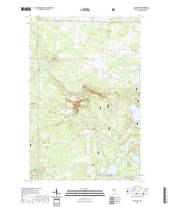
2022 Map of Dark Lake
USGS Topo · Published 2022About this map
Superior National Forest lands dominate this portion of St. Louis County, where a dense network of timber and recreational trails weaves through the northern Minnesota woods. The landscape is defined by its glacial hydrology, featuring a string of significant water bodies including Lake Leander, Dark Lake, and Knuckey Lake. The Sturgeon River and Dark River systems provide the primary drainage, with smaller tributaries like Paavola Cr and the descriptively named Lonesome Polecat Cr cutting through the forest.
Find a feature on this map
57 named features on this map. Tap any name to fly to it.
Don’t see what you’re looking for? This feature index may not catch every label — zoom into the map to look around manually.
Map Details
Editions of this 2022 Dark Lake Map
This is the sole edition of this map. No revisions or reprints were ever made.
Other maps of this area

1951 · Kinney
USGS Topo · 1:24,000

1952 · Idington
USGS Topo · 1:24,000

1954 · Hibbing
USGS Topo · 1:250,000

1955 · Dark Lake
USGS Topo · 1:24,000

1955 · Dewey Lake SE
USGS Topo · 1:24,000

1955 · Dewey Lake NW
USGS Topo · 1:24,000

1955 · Dewey Lake
USGS Topo · 1:24,000

1957 · Hibbing
USGS Topo · 1:250,000

1958 · Hibbing
USGS Topo · 1:250,000

1964 · Hibbing
USGS Topo · 1:250,000