
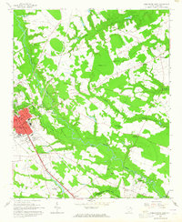
1963 Map of Darlington East
USGS Topo · Published 1965About this map
The Pee Dee region’s river-and-rail geography is clearly defined on this mid-century survey, where the winding course of Black Creek and its many tributaries like Back Swamp and Hurricane Branch carve through the landscape. The city of Darlington serves as the focal point in the west, revealing the street grid and industrial features of the era, including the Sewage Disposal facility and several borrow pits. The map illustrates a society transition, documenting rural institutions such as the Bethea Home for the Aged and numerous country churches like Pleasant Grove Ch and New Providence Ch.
Find a feature on this map
39 named features on this map. Tap any name to fly to it.
Don’t see what you’re looking for? This feature index may not catch every label — zoom into the map to look around manually.
Map Details
Editions of this 1963 Darlington East Map
2 editions found
Other maps of this area

1940 · Florence West
USGS Topo · 1:62,500

1940 · Florence East
USGS Topo · 1:62,500

1943 · Gum Swamp
USGS Topo · 1:62,500

1945 · Florence East
USGS Topo · 1:62,500

1945 · Florence West
USGS Topo · 1:62,500

1953 · Florence
USGS Topo · 1:250,000

1954 · Florence
USGS Topo · 1:250,000

1963 · Dovesville
USGS Topo · 1:24,000

1963 · Mont Clare
USGS Topo · 1:24,000

1963 · Darlington West
USGS Topo · 1:24,000