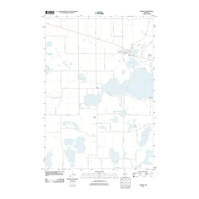
2010 Map of Darwin
USGS Topo · Published 2010About this map
The settlement of Darwin serves as the focal point of this Meeker County landscape, where the local road network converges near the Darwin Post Office. This 2010 survey reflects a region defined by its numerous water bodies and small rural communities, including the village of Casey. The township's history is anchored by sites such as Saint Johns Cemetery and Ellsworth Cemetery, which offer valuable coordinates for genealogical research in this part of Minnesota.
Find a feature on this map
49 named features on this map. Tap any name to fly to it.
Don’t see what you’re looking for? This feature index may not catch every label — zoom into the map to look around manually.
Map Details
Editions of this 2010 Darwin Map
This is the sole edition of this map. No revisions or reprints were ever made.
Other maps of this area

1953 · New Ulm
USGS Topo · 1:250,000

1953 · Saint Cloud
USGS Topo · 1:250,000

1957 · Saint Cloud
USGS Topo · 1:250,000

1957 · New Ulm
USGS Topo · 1:250,000

1958 · New Ulm
USGS Topo · 1:250,000

1958 · Saint Cloud
USGS Topo · 1:250,000

1958 · Dassel
USGS Topo · 1:62,500

1958 · Hutchinson
USGS Topo · 1:62,500

1967 · New Ulm
USGS Topo · 1:250,000

1967 · Litchfield South
USGS Topo · 1:24,000