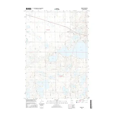
2016 Map of Darwin
USGS Topo · Published 2016About this map
Darwin and the small settlement of Casey anchor this portion of Meeker County, where a dense network of glacial lakes defines the landscape. The geography is dominated by large water bodies such as Lake Washington, Lake Stella, and Manuella Lake, which are interconnected by drainages like Washington Cr. This 2016 survey illustrates the modern road grid, including Co Rd 9 and Pacific St, while preserving the location of long-standing community landmarks. Researchers will find local history preserved at Saint Johns Cem near the town center and Ellsworth Cem further south. The map provides a detailed view of the shoreline developments around Lake Darwin and the smaller, uniquely named Eighty Acre Lake, reflecting the area's transition into a modern recreational and residential lake district.
Find a feature on this map
65 named features on this map. Tap any name to fly to it.
Don’t see what you’re looking for? This feature index may not catch every label — zoom into the map to look around manually.
Map Details
Editions of this 2016 Darwin Map
This is the sole edition of this map. No revisions or reprints were ever made.
Other maps of this area

1953 · New Ulm
USGS Topo · 1:250,000

1953 · Saint Cloud
USGS Topo · 1:250,000

1957 · Saint Cloud
USGS Topo · 1:250,000

1957 · New Ulm
USGS Topo · 1:250,000

1958 · New Ulm
USGS Topo · 1:250,000

1958 · Saint Cloud
USGS Topo · 1:250,000

1958 · Dassel
USGS Topo · 1:62,500

1958 · Hutchinson
USGS Topo · 1:62,500

1967 · New Ulm
USGS Topo · 1:250,000

1967 · Litchfield South
USGS Topo · 1:24,000