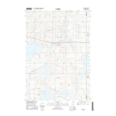
2016 Map of Dassel
USGS Topo · Published 2016About this map
The city of Dassel sits at a geographic crossroads in Meeker County, defined by a dense network of glacial lakes and small creek systems. The town center is organized around a grid of residential and commercial streets, including Atlantic Ave, Pacific Ave W, and Simons Ave W, which run parallel to the regional transit corridor. To the south, the smaller settlement of Jennie rests near the northern shore of Lake Jennie, illustrating the classic Minnesota pattern of lakeside community development.
Find a feature on this map
55 named features on this map. Tap any name to fly to it.
Don’t see what you’re looking for? This feature index may not catch every label — zoom into the map to look around manually.
Map Details
Editions of this 2016 Dassel Map
This is the sole edition of this map. No revisions or reprints were ever made.
Other maps of this area

1953 · New Ulm
USGS Topo · 1:250,000

1953 · Saint Cloud
USGS Topo · 1:250,000

1957 · Saint Cloud
USGS Topo · 1:250,000

1957 · New Ulm
USGS Topo · 1:250,000

1958 · New Ulm
USGS Topo · 1:250,000

1958 · Saint Cloud
USGS Topo · 1:250,000

1958 · Glencoe
USGS Topo · 1:62,500

1958 · Dassel
USGS Topo · 1:62,500

1958 · Cokato
USGS Topo · 1:62,500

1958 · Hutchinson
USGS Topo · 1:62,500