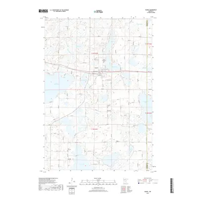
2019 Map of Dassel
USGS Topo · Published 2019About this map
Dassel sits as the central hub in this Meeker County landscape, defined by a dense network of glacial lakes and small rural settlements. To the south, the community of Jennie is positioned near the shores of Lake Jennie, where the Lake Jennie Cem serves as a significant marker for local genealogical research. The terrain is characterized by numerous water bodies including Lake Washington, Spring Lake, and Collinwood Lake, all connected by seasonal drainages like Washington Cr and Silver Cr. These lakes are interspersed with several historic burial grounds, such as Steelsville Cem and Pioneer County Cem, which suggest long-standing rural community ties. The road network, including Co RD 29 and Atlantic Ave, illustrates the transition from organized town grids to the more fluid sections of the surrounding lake country.
Find a feature on this map
58 named features on this map. Tap any name to fly to it.
Don’t see what you’re looking for? This feature index may not catch every label — zoom into the map to look around manually.
Map Details
Editions of this 2019 Dassel Map
This is the sole edition of this map. No revisions or reprints were ever made.
Other maps of this area

1953 · New Ulm
USGS Topo · 1:250,000

1953 · Saint Cloud
USGS Topo · 1:250,000

1957 · Saint Cloud
USGS Topo · 1:250,000

1957 · New Ulm
USGS Topo · 1:250,000

1958 · New Ulm
USGS Topo · 1:250,000

1958 · Saint Cloud
USGS Topo · 1:250,000

1958 · Glencoe
USGS Topo · 1:62,500

1958 · Dassel
USGS Topo · 1:62,500

1958 · Cokato
USGS Topo · 1:62,500

1958 · Hutchinson
USGS Topo · 1:62,500