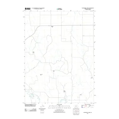
2011 Map of Davenport Table
USGS Topo · Published 2011About this map
Pleasant Hill stands as a focal point in this portion of Custer County, situated on the high ground above a complex system of drainage and relief. The southern edge of the map is defined by the winding course of the South Loup River, which contrasts with the ephemeral Dry Creek to the north. The terrain is characterized by dramatic breaks in the plains, most notably the Davenport Table and a series of deep cuts including Upper Powell Canyon, Lower Powell Canyon, and Pine Canyon. These features illustrate the erosion patterns typical of the Nebraska Sandhills periphery. Genealogists and local historians can locate the Wilhelm Cemetery in the southeast, while the secluded Hidden Valley offers insight into the localized geography that defined early ranching and homesteading in the region.
Find a feature on this map
16 named features on this map. Tap any name to fly to it.
Don’t see what you’re looking for? This feature index may not catch every label — zoom into the map to look around manually.
Map Details
Editions of this 2011 Davenport Table Map
This is the sole edition of this map. No revisions or reprints were ever made.
Other maps of this area

1948 · Linscott
USGS Topo · 1:62,500

1950 · Linscott
USGS Topo · 1:62,500

1951 · Callaway NW
USGS Topo · 1:24,000

1951 · Anselmo SW
USGS Topo · 1:24,000

1951 · Callaway
USGS Topo · 1:24,000

1954 · North Platte
USGS Topo · 1:250,000

1955 · Broken Bow
USGS Topo · 1:250,000

1956 · Broken Bow
USGS Topo · 1:250,000

1956 · North Platte
USGS Topo · 1:250,000

1957 · North Platte
USGS Topo · 1:250,000