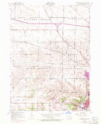
1953 Map of Davenport West
USGS Topo · Published 1971About this map
Davenport expands westward during the mid-20th century, where rural sections and townships like Blue Grass and Hickory Grove meet growing urban boundaries. The landscape is defined by the Chicago Rock Island and Pacific railroad and the historic path of Telegraph Road, while older patterns of land use are visible in the scattered numbered school districts and family plots like the Friday Family Cemetery.
Find a feature on this map
33 named features on this map. Tap any name to fly to it.
Don’t see what you’re looking for? This feature index may not catch every label — zoom into the map to look around manually.
Map Details
Editions of this 1953 Davenport West Map
Other maps of this area

1890 · Durant
USGS Topo · 1:62,500

1891 · Davenport
USGS Topo · 1:62,500

1894 · Durant
USGS Topo · 1:62,500

1894 · Davenport
USGS Topo · 1:62,500

1901 · Rock Island
USGS Topo · 1:125,000

1910 · Rock Island
USGS Topo · 1:125,000

1912 · Milan
USGS Topo · 1:62,500

1916 · Edgington
USGS Topo · 1:62,500

1938 · Edgington
USGS Topo · 1:62,500

1944 · Milan
USGS Topo · 1:62,500