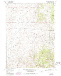
1968 Map of Davidson Flats
USGS Topo · Published 1985About this map
Davidson Flats and the high country of the Medicine Bow National Forest define this 1968 landscape in Albany County. The map shows a remote Wyoming terrain where water sources like North Creek and McFarlane Creek dictated the movement and settlement of early ranchers. A notable Landing Strip is positioned near Palmer Canyon, indicating the reliance on small aircraft for access to these isolated sections of the range.
Find a feature on this map
26 named features on this map. Tap any name to fly to it.
Don’t see what you’re looking for? This feature index may not catch every label — zoom into the map to look around manually.
Map Details
Editions of this 1968 Davidson Flats Map
3 editions found
Other maps of this area

1954 · Torrington
USGS Topo · 1:250,000

1954 · Cheyenne
USGS Topo · 1:250,000

1955 · Dodge Ranch
USGS Topo · 1:24,000

1955 · Moonshine Peak
USGS Topo · 1:24,000

1955 · Bull Camp Peak
USGS Topo · 1:24,000

1958 · Cheyenne
USGS Topo · 1:250,000

1958 · Torrington
USGS Topo · 1:250,000

1968 · Cow Creek Mountain
USGS Topo · 1:24,000

1968 · Davidson Flats
USGS Topo · 1:24,000
1968 · Reese Mountain
USGS Topo · 1:24,000