
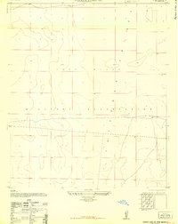
1948 Map of Davies Tank
USGS Topo · Published 1948About this map
Fort Bliss Military Reservation dominates this 1948 survey of the arid high-desert landscape in Doña Ana County. The terrain is defined by the sharp descent of the San Andres Mountains into the Tularosa Basin, where critical water sources like Texas Canyon Spring and Globe Spring supported ranching operations before the expansion of military activities. The presence of Globe Spring Ranch and several man-made improvements like Davies Tank and Globe Well illustrate the effort to sustain livestock in this environment. In the eastern flats, the emergence of early Cold War-era military infrastructure is evident at Condron Air Field, complete with its Control Tower. This map captures a moment when the traditional ranching heritage of Goodin Well and the surrounding canyons was transitioning into a highly controlled military testing and training zone.
Find a feature on this map
15 named features on this map. Tap any name to fly to it.
Don’t see what you’re looking for? This feature index may not catch every label — zoom into the map to look around manually.
Map Details
Editions of this 1948 Davies Tank Map
This is the sole edition of this map. No revisions or reprints were ever made.
Other maps of this area

1891 · Las Cruces
USGS Topo · 1:125,000

1893 · Las Cruces
USGS Topo · 1:125,000

1940 · Newman
USGS Topo · 1:62,500

1941 · Organ Peak
USGS Topo · 1:62,500

1943 · La Mesa
USGS Topo · 1:62,500

1943 · Parker Lake
USGS Topo · 1:62,500

1943 · Newman
USGS Topo · 1:62,500

1943 · Organ Peak
USGS Topo · 1:62,500

1948 · Newman NW
USGS Topo · 1:24,000
1948 · Parker Lake SE
USGS Topo · 1:24,000