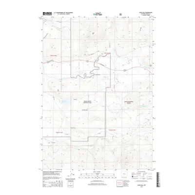
2015 Map of Davis Hill
USGS Topo · Published 2015About this map
Grand Teton National Park and the Teton National Forest intersect in this high-altitude landscape of northwestern Wyoming. The terrain is defined by a series of prominent rises including Davis Hill, Uhl Hill, and Burnt Hill, which overlook a complex drainage system fed by Pacific Creek, Lava Cr, and the larger Buffalo Fork. This area contains several water management features, notably the Elk Ranch Reservoir and Wallace Draw Reservoir, along with natural bodies like Halfmoon Lake. The map reveals the legacy of land use and resource management through named draws such as Coal Mine Draw, Uhl Draw, and Eynon Draw. Transportation across these federal lands is facilitated by established corridors like E Highway 287 and specialized forest routes including Pacific Creek Rd and Teton Wilderness Rd, illustrating the intersection of recreation and utility in the Teton region.
Find a feature on this map
30 named features on this map. Tap any name to fly to it.
Don’t see what you’re looking for? This feature index may not catch every label — zoom into the map to look around manually.
Map Details
Editions of this 2015 Davis Hill Map
This is the sole edition of this map. No revisions or reprints were ever made.
Other maps of this area

1899 · Grand Teton
USGS Topo · 1:125,000

1901 · Grand Teton
USGS Topo · 1:125,000

1902 · Mt Leidy
USGS Topo · 1:125,000

1955 · Driggs
USGS Topo · 1:250,000

1958 · Driggs
USGS Topo · 1:250,000

1962 · Driggs
USGS Topo · 1:250,000

1965 · Davis Hill
USGS Topo · 1:24,000

1965 · Green Mountain
USGS Topo · 1:24,000

1965 · Rosies Ridge
USGS Topo · 1:24,000

1965 · Mount Leidy
USGS Topo · 1:24,000