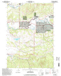
1996 Map of Davis Hill
USGS Topo · Published 1998About this map
Buffalo Fork winds through a high-mountain landscape where agricultural holdings meet protected federal lands in the mid-1990s. This survey illustrates the intricate boundary between Grand Teton National Park, the Teton National Forest, and the Teton Wilderness, highlighting the area's legacy of large-scale ranching. Distinctive properties like the Box K Ranch, Buffalo Valley Ranch, and Heart Six Ranch are situated along the river's path, while the Pinto Ranch sits further west near the park boundary.
Find a feature on this map
30 named features on this map. Tap any name to fly to it.
Don’t see what you’re looking for? This feature index may not catch every label — zoom into the map to look around manually.
Map Details
Editions of this 1996 Davis Hill Map
This is the sole edition of this map. No revisions or reprints were ever made.
Other maps of this area

1899 · Grand Teton
USGS Topo · 1:125,000

1901 · Grand Teton
USGS Topo · 1:125,000

1902 · Mt Leidy
USGS Topo · 1:125,000

1955 · Driggs
USGS Topo · 1:250,000

1958 · Driggs
USGS Topo · 1:250,000

1962 · Driggs
USGS Topo · 1:250,000

1965 · Davis Hill
USGS Topo · 1:24,000

1965 · Green Mountain
USGS Topo · 1:24,000

1965 · Rosies Ridge
USGS Topo · 1:24,000

1965 · Mount Leidy
USGS Topo · 1:24,000